Plan A

Unless a new plan is created, Raydient’s intention is to:

  • Complete the harvest of mature trees
  • Improve two of the existing logging roads with gravel surfacing and power for residential use
  • Close the property to public access including the existing trails on the property (Derailed, Camel Back, Hyperspace, and Dirt Devil)
  • Market and sell the existing 20-acre lots to individuals, families, or a single investor or company
Plan A Map

Plan B

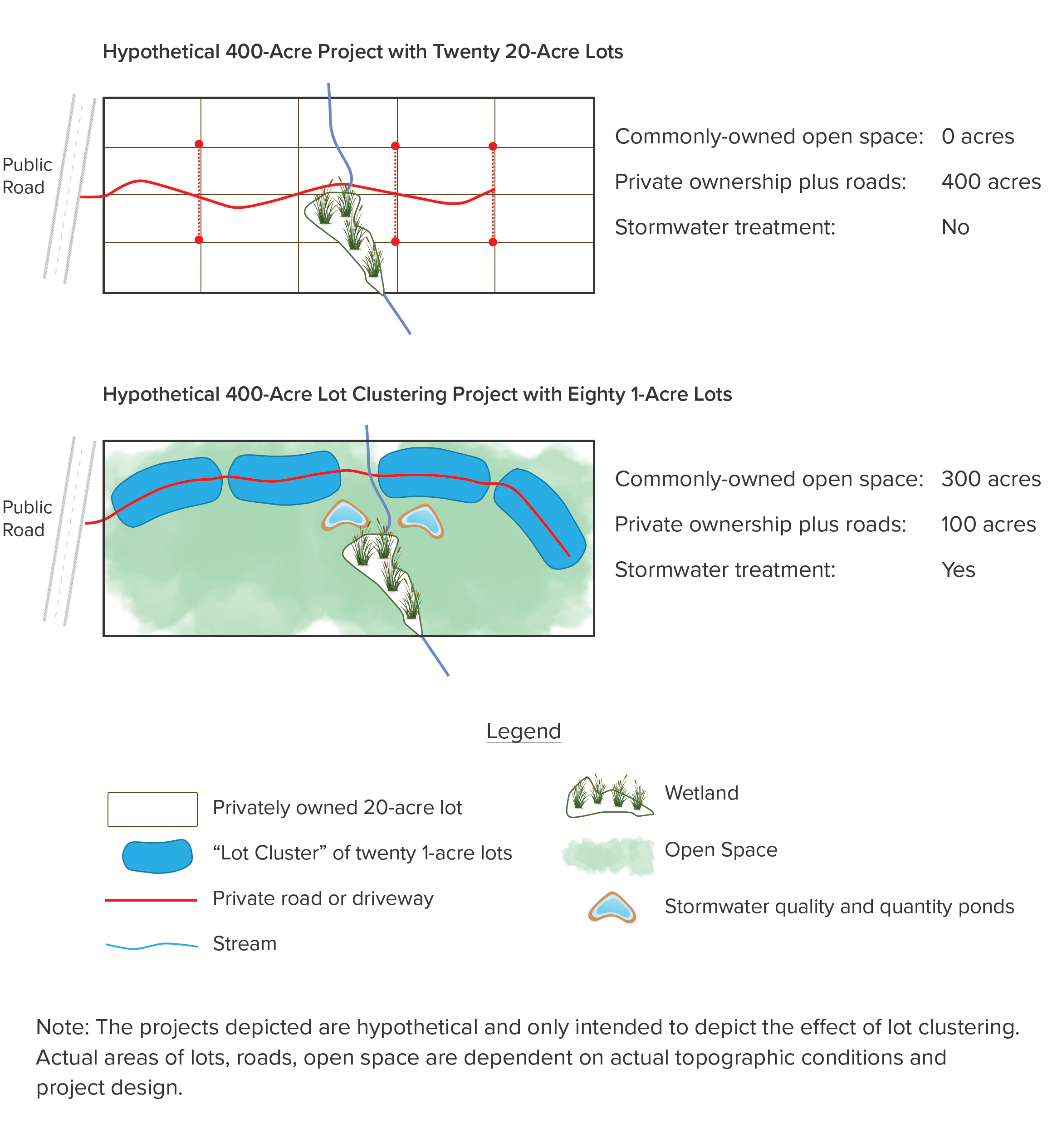
The NKU concept relies on a land planning concept known as “lot clustering.” Simply put, it reduces lot size from their maximum allowable size to a smaller, but still desirable scale.

In this case, Raydient’s requested zoning is for Rural Residential, allowing one dwelling unit per 5 acres. Rather than make all of the lots 5 acres, we will explore utilizing one-acre to two-acre lots. Roads, storm ponds, and other infrastructure typically take up an area equal to 20% of the residential area.

The examples to the right are idealized, but fully illustrate the concept and the possibilities for NKU and the community.

Plan B Maps
X

This website stores cookies on your computer. These cookies are used to collect information about how you interact with our website and allow us to remember you. We use this information in order to improve and customize your browsing experience and for analytics and metrics about our visitors both on this website and other media. To find out more about the cookies we use, see our Privacy Policy.

If you decline, your information won’t be tracked when you visit this website. A single cookie will be used in your browser to remember your preference not to be tracked.